![]()
PCT Glacier Peak Alternate Route
Bypasses the Suiattle River Bridge wash-out.
Updated August 2004... plus notes in 2007
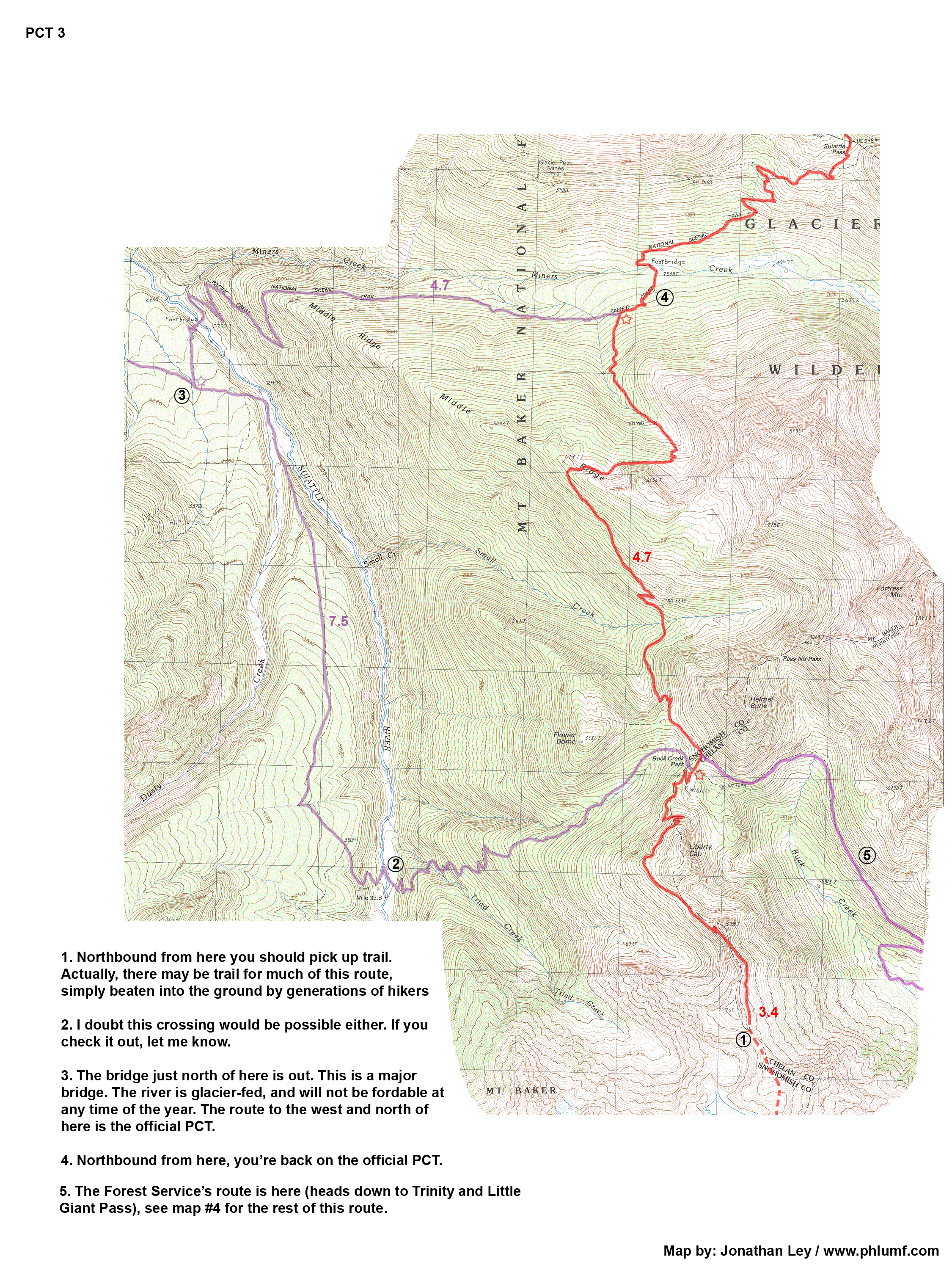
In the autumn of 2003, a huge storm hit the North Cascades and dumped tons of rain and snow onto an already saturated landscape. The water quickly built into a flood that wiped-out a number of roads and bridges. One of the destroyed bridges was a hiker/horse bridge that crossed the Suiattle River just northeast of Glacier Peak in the Glacier Peak Wilderness. The PCT is/was routed over this bridge.
The Suiattle River, fed by the numerous glaciers on Glacier Peak, can be a significant river at the crossing area. Fording the river at this location can be dangerous... if not impossible in poor conditions (with significant melt or rain). However, sometimes it can be forded quite easily late in the season - after extended dry periods and when it's not excessively warm (and/or early in the morning). This so-happens to be when many PCT thru-hikers are coming through the area. In 2006, a log was even reported to be over the stream (that's likely to be washed away by now, but perhaps another will fall...), and those who did ford the stream reported no excessive difficulty.
That said, the trail in this section hasn't been maintained since the bridge washed-out. So, if you follow the original PCT, the conditions might not be any better than some of this suggested alternate route. Expect a lot of brush and/or blowdowns. The Forest Service hasn't yet decided when, how (or even if) the Suiattle bridge will be replaced. Another storm in Autumn 2006 has re-enforced the lesson of 2003... and if the bridge had been replaced in the interim, it likely would have washed-out again. It's quite expensive to build such a bridge, and there really isn't a great spot for one in the Suiattle drainage, which is a big U-shaped glacial valley prone to occasional catastrophic flooding. Quite a dilemma indeed.
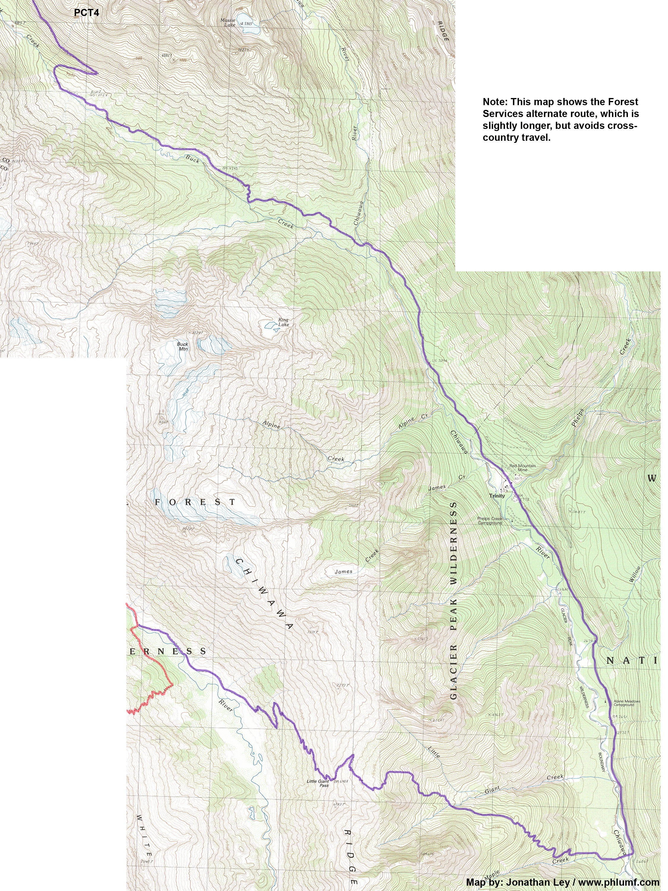
The Forest Service has suggested an alternate route to bypass this crossing. It stays entirely on trails or roads. It is detailed on their web site here. The PCTA also has this info posted on their web site here. The route is OK, but misses some really spectacular scenery close to Glacier Peak - a real highlight of this section of the PCT.
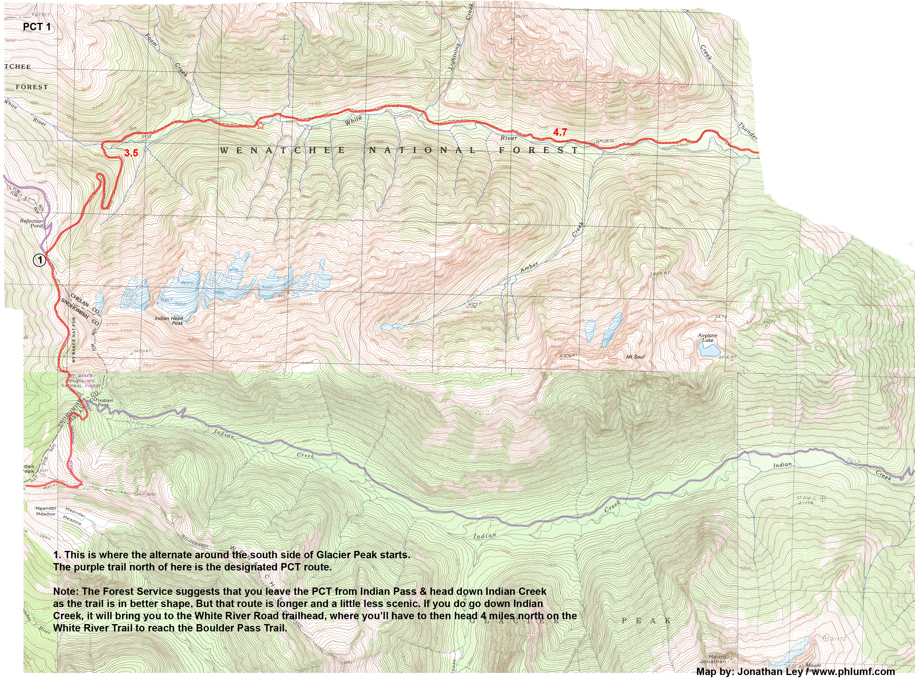
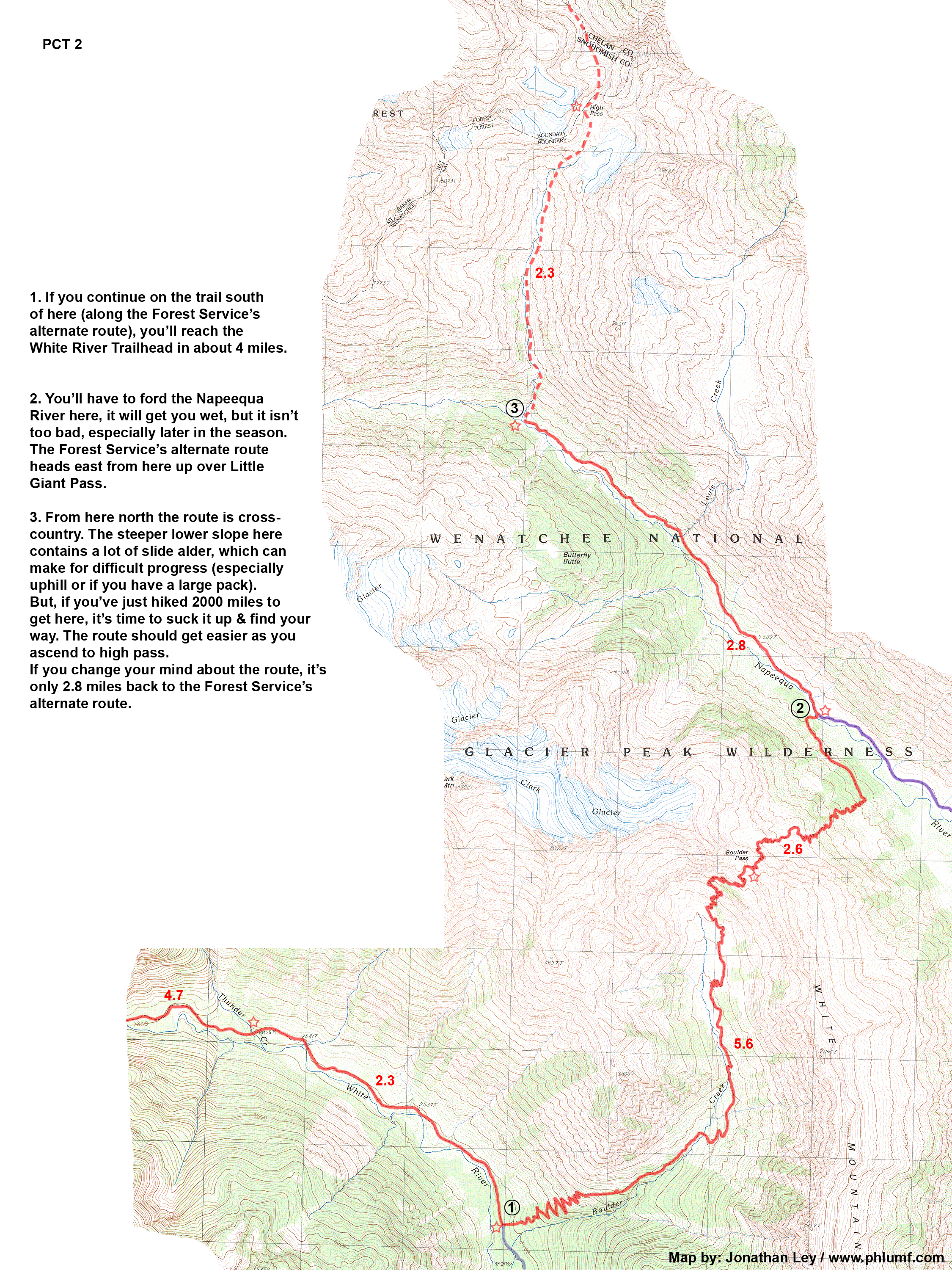
I've mapped a more direct route that includes one short "bushwhack" section. In summary the route (northbound) leaves the PCT at White Pass, follows the White River Trail to the Boulder Pass Trail, heads over Boulder Pass, down to the Napeequa Valley, up the valley to High Pass, then re-connects to the PCT just south of Suiattle Pass. (This route is often hiked by people circumnavigating Glacier Peak)
This route is shorter than the official detour, and the scenery is spectacular through the Napeequa Valley and over High Pass - on par with the original PCT over Red Pass and Fire Creek Pass.
The route does contain one cross country section north of the Napeequa Valley, and will not be suitable for equestrians. The lower part of this slope is covered with slide alder and other brush and may impede quick progress. If you've ever bushwhacked uphill through alder, you know what I mean. If you haven't, then you'll find out! But, after hiking 2000+ miles, you should be able to make it, this bit is brief and hiked by many people every year. Just pay attention to where you're going! Even if you change your mind at the last minute, if you're headed northbound, you won't be too far off of the Forest Service's alternate route. If you're headed southbound (i.e. downhill), the bushwhack should be easier.
My maps are digital images, intended to be viewed on a computer screen, or printed on 8.5x11 sheets of paper (which puts them at a scale of about 1:60000, or 1mile per inch). (I've saved the maps in the .gif format. The reason is that .gif is a fairly efficient, loss-less 8-bit color format.) To print the maps, you'll need access to a computer and a standard color ink-jet printer. The whole alternate route is contained on 3 maps, and 1 more that includes part of the Forest Service alternate. Plus, there is one "overview map" that helps you see the big picture.
I've drawn the trail with a red line & drawn parts of the PCT (and other alternate routes on map#3) with a purple line. The dotted line on map #3 indicates the portion that is cross-country. I've added a bunch of numbered notes to the maps to help you along the way. (Essentially, the maps are the same kind of format as my CDT maps - click here for more info about those, and a lot of tips on printing, etc.)
To download copies of the maps, click the links below.
Click here to download or view the overview map (1.3Mb).
Click here to
download or view map #1 (3.4Mb)
(Note: this map is rotated 90 degrees
so it's easier to print.)
Click here to download or view map #2 (2.0Mb)
Click here to download or view map #3 (2.2Mb)
Click here to download or view map #4 (2.9Mb)
Click here to download a .zip file of all 5 maps. (12.7Mb)